A walk through the valley of shadow of death and back again
The process of mountain hiking is conducive to becoming a metaphor of journey, spirituality, and life. I mean, it literally has a rising action, a climax, and falling action. For the duration of the hike, I can self-indulge and romanticize myself (or my party) as a main character(s) in some heroic journey. Hiking is a celebration of life as a process rather than a destination; and that’s a much needed for a soul that’s trapped in a “destination”-oriented mind like mine.
While hiking, I need to be hyper-aware of time and space for mundane things like daylight, my own safety, and such. Yet for the same reason, the fact that a hike occurs within the time span of a really long conversation, puts the mind in a space where internal dialogues can fester and run (read:walk) their course. Given that long internal dialogues monologues are prone to recursive thinking (…at least mine are?), it follows that the activity of hiking is conducive to forming nested micro-metaphors within the broader “hiking metaphor” as a whole.
But–and forgive me for being trite–isn’t the phenomenon that hiking is fertile with nested metaphors, itself a metaphor for life? After all, any metaphor about life is just a subset of life that is modular enough for the human mind to appreciate the parallel. Every metaphor about life is nested in life. So it really shouldn’t be a surprise that a powerful metaphor of life, like hiking, is a Russian doll of nested-metaphors.
I’m convinced that the hike on this day is somehow a metaphor for all my other days. This is my absolute favourite “story” to tell about my trip because the things that happen in a certain sequence within a certain time. On a deeper note, I love telling it because I feel like the story hasn’t ended yet. I feel like this day had more subtle metaphors I haven’t fully teased out, and perhaps symbolism that I don’t yet know the meaning of.
Having had my first request to the universe fulfilled, I sought to try my luck with my second request for my last day in Garmisch-Partenkirchen. My goal #2 was to “Reach the summit of a mountain”. Time was limited as I needed to take the train to Innsbruck that night, but I had a plan. I was “somehow” going to go through Höllentalklamm (translates to Hell’s Valley Gorge), which is point (3) to (4) on the map below and “somehow” get to the cable car on the mountain Alpspitze (which Google translates to Alp Peak or Alps Point). In other words, a flawless plan.
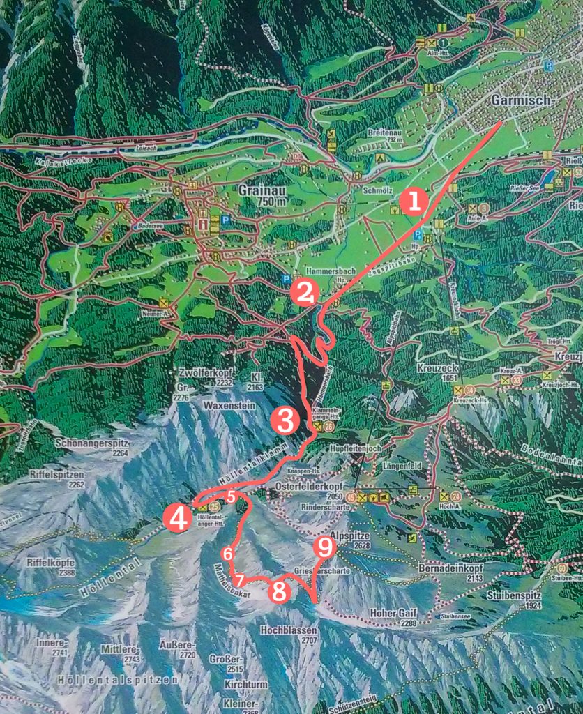
“Somehow” getting to (3) wasn’t too bad. Since it was a Sunday, and nothing is Germany seems to be open on Sundays, I was worried that the cable car from Alpspitze would be closed too. So I walked past the cable car loading area (1) first to check that it was going to be open. This effort ended up being frivolous, but more on that later.
I walked in from Garmisch-Partenkirchen in some sort of large field and then a tiny village called Hammersbach (2). The accent from (2) to (3) was nice and easy. There were very few people there since it was still early. It was misty the entire day and it rained pretty much the whole day too. Not the storm-cloud type, but the fully-white-sky-with-no-blue-breaks kind (as you will see in the pictures below).
Hell’s Valley Gorge
Höllentalklamm (Hell’s Valley Gorge) lasted the span of (3) to (4) and lived up to its name by being both fierce and gorgeous. My pictures and videos do it no justice. So I’ll keep my experience in Hell between me and … uh, the devil? Or you could also search up blogs of others going through it, as long as the gorge isn’t frozen solid, my experience would be quiet similar to any other. It’s quite popular, but more dangerous and therefore a little less touristy than Partnachklamm (the gorge I went through two days ago).
The Mass at Hell’s Valley
Above Höllentalklamm is the valley area, Höllental (Hell’s Valley). By now, the combination of rain and passing through the gorge left me cold, wet and miserable. Luckily I stumbled upon Höllental Angerhütte, (4) on map, a cabin for people hoping to get an early start at tackling the tallest peak in the region, Zugspitze.
As I regained my composure under the sheltered area, I noticed a collection of strange things. The other people under the shelter were all wearing sports gear (not surprising), but they also seemed like they were very comfortable and very at home. They were sitting on the benches looking towards the same direction. An area under the shelter was left open. Then some dudes with kilts and funny hats came out with bagpipes and while 3 people on the side started singing a mixture of Acapella, and (what I would consider) yodeling? One, differently dressed dude, came up and said a few words in German. (And they were funny words because people laughed). Then everyone on the benches clapped and sang as the 3 singing people led what I then realized was worship.
I had decided earlier that day that I didn’t have time to go to church and climb a mountain (forgive me)… so I could not help but laugh at the irony of being on my way up a mountain and arriving just in time for Sunday Mass in Hell’s Valley. Touché.
When divine intervention brings church to you in hell, the least you can do is stick around for the service. The service was a really nice contrast the the miserable, wet fog one step out from under the shelter. The songs were cheery, speakers made jokes, the “congregation” laughed heartily. I was really intrigued that everyone knew when to make the correct hand-gestures in unison and were able to recite liturgy in unison. The only thing I understood was when they recited the Lord’s Prayer at the end. It turns out the Lord’s Prayer recited out loud in German has the same rhythm as the Lord’s Prayer recited in English and Cantonese.
That said, as the only clearly not European/German speaking body under the shelter, I dared not take pictures here and just enjoyed sharing something deeply in common with a group of strangers half-way through a journey that I expected to be an entirely solo endeavour.
Alpspitze via Matheisenkar
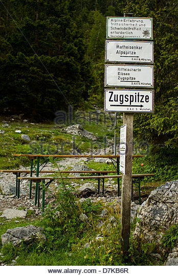
After attending Mass, there were a couple options for going up Alpspitze. I really wish I took a picture of that iconic signpost that listed my potential futures.
It looked very similar to this picture on the left …in fact, this could have been the exact one. But I think it’s not because the one I saw listed the expected number of hours for completion.
I thought for a few moments and set myself on an irreversible path called Matheisenkar. I chose the shortest path up Alpspitze because I still wanted to have time to go down and go to Innsbruck (I was so, so naive).
The signpost I saw also had some words in German that I ignored for obvious reasons.
Anyway, I just tried to translate this stock photo apparently “alpine erfahrung trittsicherheit und schwindelfreiheit erforderlich” translates to “alpine experience requires sure-footedness and no fear of heights“.
Ha! If only I knew this 5 months ago…
Zooming in on the map above, the signpost was beside Höllental Angerhütte (4) and (5)-(9) is Matheisenkar.
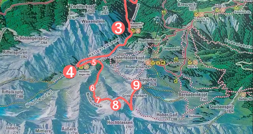
This leg of the hike began with a very steep ascent. It was still manageable for the first several minutes and I loved every second of it. There’s a critical zone of not being too easy and not being too hard and I loved how the steepness mixed with the rain made it a nice challenge (so cocky). As I ascended, I must have traced the rain back to its source cloud.
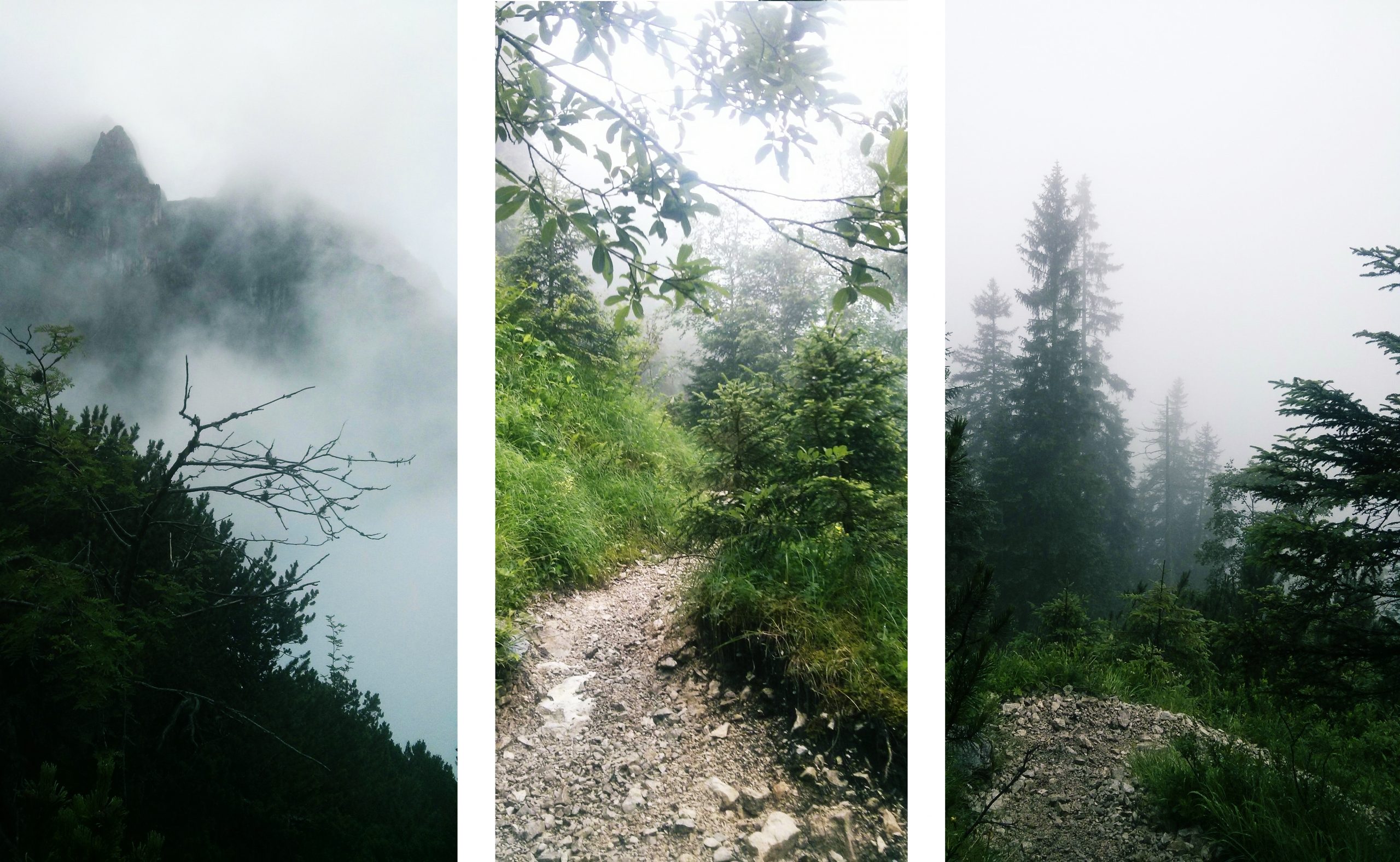
the path before things got weird.
I think around the vicinity before (5) on the map, things started getting weird.
Let’s see what I can remember:
- Exhibit A: The path was getting narrow. Like, way. too. narrow. I would be gripping the slippery wet rock on my right for my dear life, because when I looked down to the left, all I could see was fog.
- Exhibit B: there were those parts where I had to climb patches of rock. Actually gripping larger pieces with my trusty gloves and pulling myself up 5 metre vertical stretches. I would have to find a “good position” to orient my body to rest half way up these stretches. This was super scary because the rocks were wet and slippery, and some of them were loose … so I had to make sure I didn’t rely on one of those/preemptively kick those down so that using them wasn’t an option. Sometimes the rocks were just too slippery for me to get a grip, so I pulled on pine trees (if there were any) beside me like rope. If I fell, I would slide into the foggy abyss below.
- Exhibit C: Sometimes the trail would be nice enough to have a cable bolted onto the face of the rock for you to hold on to… when there are cables like these, there’s a pretty steep drop on the left and a very narrow strip of rock for walking (narrow enough to not be able to fit both feet side by side). But ultimately cables these are good signs because 1. I can hold on to it, 2. it’s a sign of humanity, and 3. it’s a sign that I’m going the right way. Most times, this trail did not grant me such mercy. Like, I wish all the Exhibit As were Exhibit Cs.
Also, I think I would have been much more reassured if I saw someone else on this hike. But of course, I didn’t see another human being on this trail. Down in Höllental, there were several hikers choosing to continue hiking, but they all went on other paths. It was pretty creepy. I really regret not telling anyone where I intended to hike before hiking. I also really really didn’t want to keep going if this trail was going to get worse. But I really really really didn’t want to turn back and go through all those obstacles again (in fact they are probably harder going down than coming up!). So I pressed on with the hope that 1. things would get better and 2. that I can take the cable car down (–I’d pay anything).
So I hope I made it apparent that the path between (4) and (5) scared the proverbial shit out of me. Needless to say, I have no pictures to show what these looked like as I was busy fearing for my life, wondering how long it would take for someone to notice I am missing, how long it takes someone to find a dead body, etc. Not that the touch screen camera button on my phone would have responded to the wet, cold fingers under mud-stained gloves anyway.
The distance between (4) and (5) looks close on the map that projects the trail on an X-Y plane, but is was actually more vertical displacement (Z) than horizontal (X, Y) …. at around (5) I was able to take a break without fearing for my instantaneous safety and take the panoramas below:
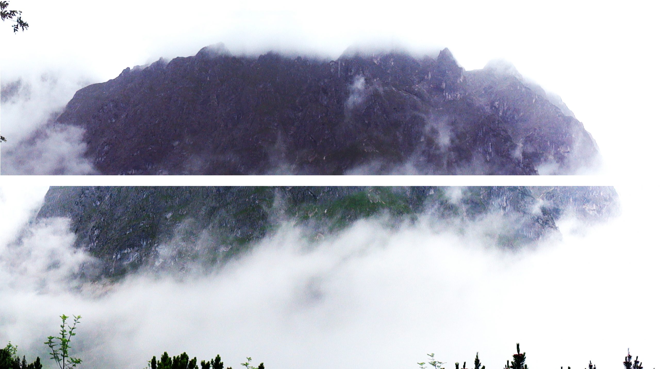
Looking across the valley from (5) to another range called Waxsenstein.
Meanwhile, looking down was still a foggy abyss, opaque white. Falling would be a vertical drop into literal Hell(‘s Valley). I did some post-processing on the photo to make the mountains visible, but really seemed to be different shades of white. It kind of made reality seem dull and simultaneously enhanced the drudgery and dread of it all.
Between (5) and (6) was more horizontal. Still a narrow path though. Looking up towards the right between (6) and (7), I could see these guys… my mammalian brethren! (really desperate to see other humans about now)
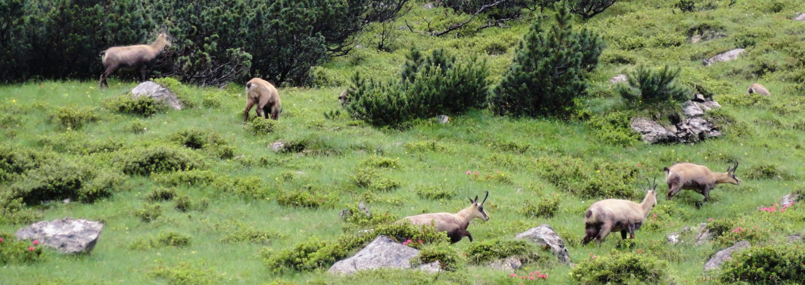
Living things that frolicking with no fear of death
Look at them thriving like it’s no big deal. I was so jealous.
Until now, when I “WTF. IS THIS FOR REAL“ed at the trail and thought that I for sure went astray somewhere, the trail markers had been very helpful. There would be red dots spray painted on rocks followed by spray painted “up arrow” which roughly translates to:
“Yes. Indeed, you are to climb up this 80 degree incline with your bare hands.”
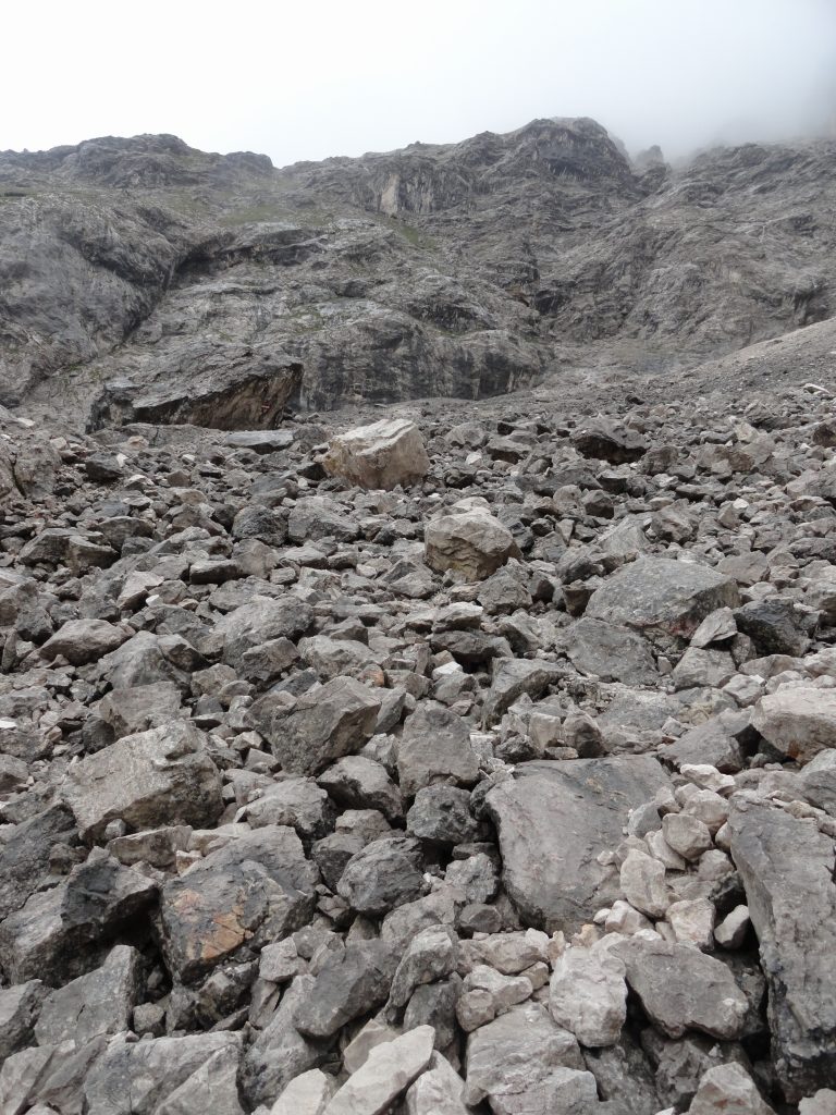
field of loose rock
Then, “reassured”, I would be able to justify the strange maneuvers I’d have to undergo to “hike” on this “trail”.
Now, at (7) instead of a narrow, narrow path, I saw the following:
- To my right: a glacier/huge piece of ice going all the way up into the clouds (and presumably beyond)
- In front of me: a large field of loose rock
- On my left: and the large field of loose rock continuing to the left … sliding down to, well, Hell again.
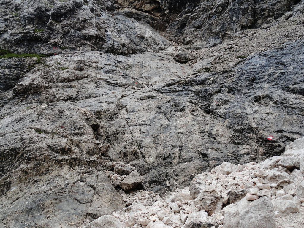
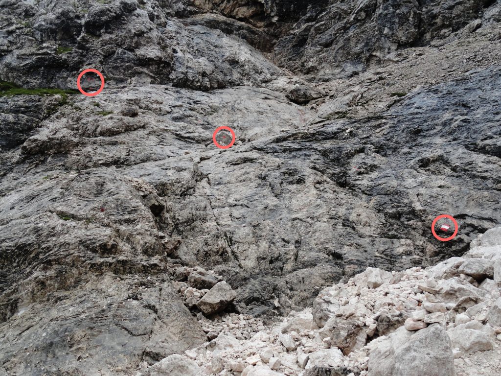
I did a double take, “This must be wrong. Usually large fields of loose rocks are not trails right?” I scan for the trusty trail marker. And what do you know, there are trail markers on the rock field.
Can you spot the trail markers here?
I bumbled along the rock field. It was a lot windier here without the protection of the side of the mountain. I felt like I might just get blown off and die. At this point either I heard thunder in the distance, or the wind is just that loud. Every time I reached a trail marker, I had to scan for the next one. It was really humbling because the rock field was effectively homogeneous and I couldn’t make out a path with the visible eye, so I was really at the mercy of the trail markers. Yet rarely did I see more than one at a time. It was like playing “I-spy”. Except my life depended on winning a little more.

Taken with me on the loose rocks beside the glacier thing between (7) and (8) looking back where I came from between (6) and (7), I still can’t believe I came all the way around that thing without dying. Or maybe I am dead and I’m just taking this picture as a ghost.
Eventually somewhere between (7) and (8), I couldn’t see another trail marker. I looked and looked and couldn’t see one. I was actually so frustrated that this might be the reason I have to turn back. I think I walked around a bit, looking for any signs of a path … locally… at a distance… anywhere.
And then I saw it!
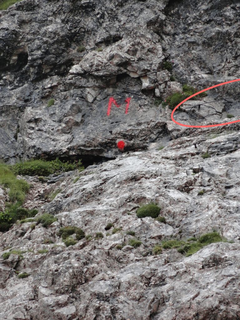
A little bit of context, this M with a dot was seen on a vertical face of rock. I may have been 50m or so away from it, and I had to zoom in a lot on my camera (and then enhance the colour) just for it to show up on the camera. I tried to go closer to it, but there seemed to be a huge gap between where I was and where this face of rock is. Also, upon looking closer, I realized that beside the red dot was a series of cables (the first one is circled on the picture). The cables are angled like this:
\
/
\
/
one top of one another all the way into the higher altitude clouds, with no place to put my feet.
I thought about attempting it for about 2 seconds before coming to my senses. My non-existent arm strength would not be able to do the consecutive pull-ups I would need to do to get up there. The drop was way too intimidating. Cold, wet, cable-car-less, and generally miserable, I had to turn back. I just couldn’t believe there was a day hike that I didn’t have the tenacity to finish.
On the way back, at before (7) on the map, I bumped into a group of English-speaking hikers, a mix of young and old. Flabbergasted that they can be so cheery even at this point of the trail, (and I was actually SO excited to see other humans), I initiated a conversation:
“Have you been on this trail before?”
“Nope!”
“I had to turn back because there was a part were the next trail marker was on the vertical face of a cliff!!”
“There are plenty of us ..we can afford to lose a few!”
I was so jealous that they could have fun on this hike with laughter because they were able to do it together. I realized that this would have been a much better experience if I went with someone else, and if I only needed to be aware of my sure-footedness without having to worry about being injured and not found. I was really tempted to follow this group back up to see how they would face the wall that turned me back, whether they would know how to climb it. I decided against it, mostly because I believed that they would also be turned back by the same wall, in which case I would have to come back down the way I came from anyway.
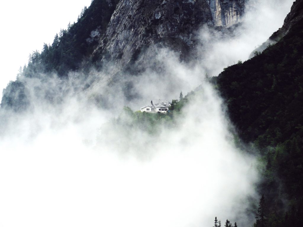
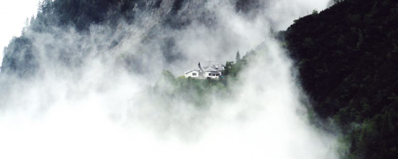
By the time I reached (6), the fog was clearing up, I looked to the right across the valley and saw a house of sorts. On my way up, this was completely covered and I had no idea I walked past it. It made me wonder what else I couldn’t see because of the fog.
The rest of the way down actually wasn’t too bad… I was most distracted by resentment and regret and disappointment.
By the time I made it back to town, I made peace with the reality of this leg of my trip. I had exchanged my request to the universe to “Reach the summit of a mountain” for “I’d rather not die trying”.
Remember this picture of the map I took after getting lost the first day I was here?
In the wider context of possible trajectories, over the past 3 days I’ve had the privilege to try out these three:
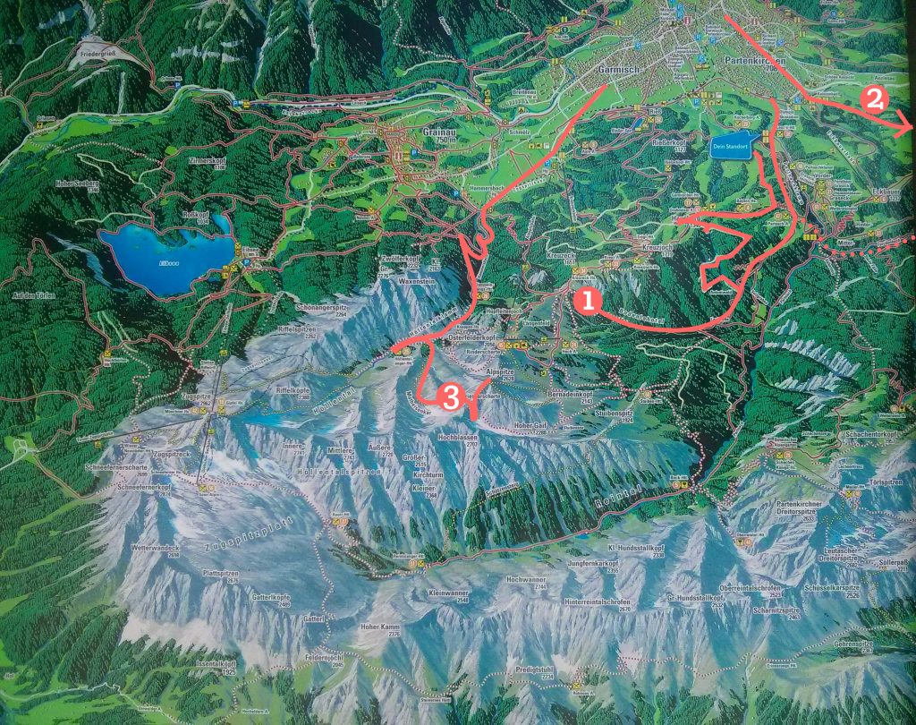
and I was satisfied.
A couple hours later, I was warm and safe in Innsbruck, Austria. The AirBnB host welcomed me so sweetly. I took a warm shower in a bathroom that had heated floors and everything.
Then, I did what anyone would do after going through something they couldn’t understand…. and searched up the route I took. I was dumbfounded when I saw this:
People were wearing helmets, carabiners, and harnesses to do this hike…
Those cables that I was hold onto for dear life in Exhibit C, I was supposed to attached my non-existent harness to those.
Back on the mountain, I resolved to never, ever go mountain hiking alone.
Now that I’m on solid ground, I really wish I could go on a multi-day hike in the mountains someday.
